OUR DRONE SERVICES
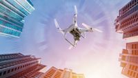
If you are reading this section we already know that you are searching for someone who can do professional drone flights for you. That's definitely us! Our offer includes services from commercial photo and video recordings to expert technical inspection flights of photovoltaics, windturbines, bridges, roofs and underwater inspections for water dams etc. We also specialize in photogrammetry and 3D models as well as in building digital twins for unique architectural structures. We have our own drones but we can also use your equipment and software if you prefer such option. If you don't see in our portfolio the type of the project you have in mind, then please contact us directly.
WINDTURBINES INSPECTIONS
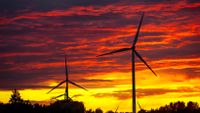
We are able to identify the smallest defects before they become a big problem. We concentrate on recognizing lighting strike damages, delamination, leading edge erosion, blade furniture detachment, blade cracks and more. Preventative maintenance inspections are the best way to save you money on costly repairs which might take place in case if the defects don’t get recognized on time. We work mostly onshore but offshore might also be possible in the future.
PHOTOVOLTAIC INSPECTIONS
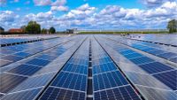
We investigate specific photovoltaic panels one by one and get the view of the whole farm within a few hours depending on the field's size. We recognize small and large damages as well as thermal differences which might cause you loss in energy production if not recognized on time. You can have the job done much faster and more precisely than with on the ground team of regular service workers.
ROOF INSPECTIONS
Get your building or rooftop inspection to evaluate leaks, shingle condition, structure damages and to check existing solar panels. Easily collect valuable data for repair and renovation decisions. Combining rooftop photography with orthomosaic mapping can further expand the information accessible at your fingertips. View huge rooftops in a single image. Collect measurements on rooftop objects and determine dangerously damaged parts in the structure.
FACADE INSPECTIONS
Our high-resolution photos and videos can capture the smallest exterior surface details at any height. There is no reason to hire a scissor or boom lift, which will take much more time to deploy, will cost more, will not provide the same level of media/documentation, and may not provide access to investigate issues on taller structures. Drone inspections solve problem of hiring extra people and cut the inspection's time in half.
PIPELINE INSPECTIONS
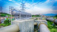
Traditional pipeline inspections have been usually done on foot, in a vehicle or in a helicopter. All of these methods present their own problems like safety, efficiency or high costs. Our drone pipeline inspection and monitoring service eliminates all of those problems. We can cover lots of ground, quickly. Identifying defects, leaks, corrosion, environmental issues and theft from pipelines whilst carrying out our survey. Our service provides a complete map together with high-resolution images and video of your pipeline, and we can get into all the places traditional methods can't. We can cover water pipelines as well as oil and gas pipelines all around European Union
POWER LINES & TELECOM TOWERS INSPECTIONS
It is very important to understand radio-, cell- or powerline-towers condition, existing mounted equipment, and damages done by birds and environmental conditions such as rain, wind and low temperatures. We can capture all angles of the tower in an easy and safe way by avoiding the danger. We can efficiently inspect multiple towers at once saving you time and avoiding the risk of having workers climb up to the top. We can complete flights also in winter to check of the ice coverage and to give you details of thermal situation of the structures.
CONSTRUCTION MONITORING
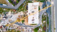
If your company is running long term large construction projects such as roads, railways, bridges, dams, and utility facilities building, then we can help you with our drone services in every phase of the project. In planning phase site features can be extracted, overlaid on top of a georeferenced site photo, and incorporated directly into an AutoCAD workflow. Next, we can monitor the project's progress what allows the managers to better predict problems before they occur. In the final phase we can fly over the whole construction and our drones can produce the report showing the completion of your project while it is ready for commissioning.
BRIDGE INSPECTIONS
We can help you visualize bridge condition, localize structural weak points, or show off your newly completed bridge construction on a wonderfully made commercial video. Drone enables you to collect powerful data as well as capture beautiful marketing imagery. With a single flight you can also get the detailed measurements of specific structural elements. There is a clear advantage for Drone Bridge Inspections because drones are easily capable of reaching the heights and depths of these structures without placing individuals in hazardous situations.
INFRARED THERMOGRAPHY
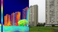
Thermal imaging also known as infrared thermography (IRT), is the process of using thermal cameras to capture images of objects by using the infrared radiation (heat) emitted by these objects. The resulting thermal images (thermograms) show the spatial distribution of temperature differences in the scene captured by the thermal cameras installed on the drone. By using IRT you can prevent problems before they get worse. Our drones can capture high-resolution infrared photos of buildings and infrastructures to spot anomalies and identify water damage, heat leakage, or other potential problems. Thermal visualization is popular for solar panels inspections, roof inspections, hidden damage building diagnosis, agricultural inspections, outdoor electrical facilities inspections and many more.
MINING / GRAVEL EXTRACTION SITES
We are offering wide range of services within mining industry - from evaluating the potential mine land, to creating models of open-pit mines which are already operating. Data received from our drones can help in planning every day operations as well as in creating a plan for returning the land back to a natural state at the project’s conclusion. Mines and mining operations are often located in remote locations with challenging terrain, including steep embankments and unstable ground foundation. Using drones to gather data keeps your team away from dangerous areas and provides additional safety.
MAPPING & SURVEYING
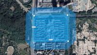
We provide base mapping and drone surveys to landowners, engineers, and architects for power and utility planning, land-use planning, environmental surveys, earthworks, mining feature assessment, commercial development, landfill surveys, and more. Traditionally survey techniques are slow and considerably more expensive therefore using drones for your inspections is highly recommended. Combine geographic information with remote sensing to gather the most accurate site surveys and maps – often with precision of one centimeter.
LiDAR
LiDAR (light detection and ranging) data is electronically compiled with GPS technology to create a digital representation of the data collected, which professional surveyors can then use to build a great number of deliverables for their clients. Drones equipped with LiDAR and other instrumentation measure the light’s reflection and range from an object’s surface to an object across millions of beams. Thit data is used to create a digital file called a point cloud. A professional surveyor can then turn this point cloud into a number of different final products including contour files, 3D maps, etc.
PHOTOGRAMMETRY
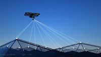
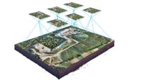
Photogrammetry is the science of making measurements and mapping from digital or hardcopy photographs. Aerial photogrammetry enables the accurate mapping of 3D coordinates on the ground, using 2D coordinates measured on stereo aerial photographs that see the same points on the ground from two or more different perspectives. Photogrammetry is typically used to create topographic maps which depict the three-dimensional shape and features of the ground onto a two-dimensional surface, and can also be used to produce contour line maps or Digital Terrain Models (DTMs), map corrected aerial imagery, and planimetric feature maps.
3D MODELLING / DIGITAL TWINS
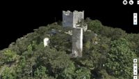
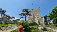
Let us transform your physical building into 3D, digital model you can navigate with nearly any device. While traditional scans take weeks on site just to capture all of the necessary data, our company can provide you with non-invasive building scans done by our drones within a few hours. Along with your preferences, we can also create a full-scale digital twins for your property facilities. The results can be delivered to you in a downloadable file and be completed within few days or few weeks depending on the size of your facility. This solution is perfect if you would like to create digital walk through an old castle, ancient church or get documentation for the historical monuments for the museum or private site. Many assets such as highways, roads, dams, and bridges can also benefit from having a digital twin (a real-time digital counterpart of a physical object is often useful in case of any natural disaster which destroys the original physical object)
WILDLIFE MONITORING AND NATURE CONSERVATION
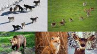
In wildlife, drones are used to count, study, and protect animals from harm. They are far more accurate at counting species and can record vast amounts of data quicker than a person could. Drones can also capture images from a bird’s-eye view, giving them the edge over traditional field research. Drones are often considered to be superior to manned aircraft. Research in Drones indicates that an advantage is the avoidance of the frequent fatalities that have sadly occurred when manned aircrafts are used for wildlife monitoring. We love animals and our company will make sure to operate wisely in all the natural environment.
FORESTRY MANAGEMENT
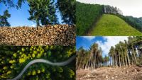
By viewing the forest from a bird's eye view, you can actively control the tree population. Drone technology far surpasses the possibilities of conventional forest aerial surveys with small aircraft in terms of efficiency and area coverage. The technology also offers enormous time and cost savings. We can easily provide accurate tree counts, map harvest units and conduct post-harvest waste assessments, plan access roads and infrastructure, remove trees with software for bare earth terrain models, do 3D scan of the forest and run inventory management. Newest technology enables automation which allows for active monitoring, precision and up-to-date data.
UNDERWATER INSPECTIONS
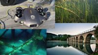
Our drones are remotely operated from the ground. We get all the data for your company without involving diving crew. This solution is much faster and it eliminates the risk of getting people injured while completing the diving mission. Our drones can be easily deployed to quickly assess problems related to the critical infrastructure. This pre-recognition of potential structure damages makes things easier for the maintenance team who is being sent underwater later on. This type of inspections can be completed for bridges, piers, dams, penstocks, and other types of structures partially located under the water.
AGRICULTURE MONITORING
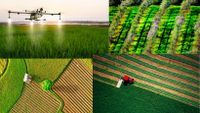
With our drone flights we can provide you with a rapid and therefore efficient documentation of the agricultural inventory, identify plants diseases, predict optimization of the irrigation of the cultivated area, determinate ideal harvest time, improve the use of plant protection products and many more. Start optimizing inputs and driving down your costs today with our amazing drone solutions. In agriculture, growers must cut costs while maximizing the land’s economic production. Elements like weather patterns and land movement can present a major challenge, especially over hundreds or thousands of acres of land with different ecologies, assets, and environmental obstacles.
COMMERCIAL PHOTOS & VIDEOS
MARKETING / EVENTS VIDEOS
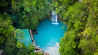
Get aerial photos and videos of your location, products, properties and special events with breathtaking drone footage shots. Show your customers previously unseen angles of your properties and give them reason to visit you in person and spend more money on your products or services. By marketing your business with truly unique content, you can significantly improve your ability to attract and retain customer's attention. This is a perfect solution for companies running sport events, health retreats, or simply offering vacation housing for the best holidays on the earth.
DRONE SOLUTIONS FOR LANDSCAPE
AND GARDEN ARCHITECTS
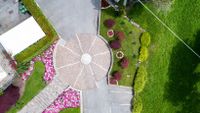
Drones have multiple applications for landscape architects, from early efforts like site analysis to creating awareness and excitement for a completed project. While working on large scale projects such as gardens, parks or recreation areas, data collected by drones in the early phase of planning the field is crucial because it can deliver measurements necessary for localization of the plants and other facilities. Additionally after the project is done, our drones can register final view of the area and you can get a gorgeously made video for your clients.
REAL ESTATE DRONE SOLUTIONS
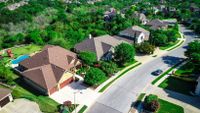
We offer both residential and commercial real estate footages. By using amazing photos and videos showing your properties from the air, you and your business can stand out of the crowd and create a "wow effect" for your prospective home buyers or tenants. If you have fantastic drone video it may even happen that your clients will buy a house from you without even visiting it or talking to you. It's definitely worth it, especially that we make things faster than other companies on the market.
GOLF COURSE MEDIA
There is no better way to attract new clients and give them a sense of what they will experience than by showing them your golf course through an amazing video and photos made from the air. We can create fantastic aerial media for your website and social platforms. This way your prospect customers will be able to feel like they are already playing the game, even before they come to the golf course in person.
"Benefits of using drones for inspections"
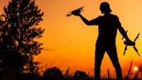
Drones have revolutionized various industries by providing cost-effective and efficient means of inspection. The use of drones has made it possible to inspect areas that were previously inaccessible. Modern drones equipped with high-quality cameras can provide high-resolution images and videos of areas that would have been difficult or impossible to capture using traditional inspection methods (...)
"Showcasing Castle Properties with Digital Twins"
Welcome to the captivating world of castle digital twins, where the past comes alive through cutting-edge technology. In this blog post, we will explore the immense potential of digital twins in showcasing the rich history of the castle properties. Discover how these virtual replicas can breathe new life into ancient walls, captivate visitors, and elevate the overall experience of your historic property (...)
"Creating promotional videos for Castle Properties"
Since many of you have been asking about our castle projects we decided to share with you some information from behind the scenes. Privately we were always passionate about the castles and their history therefore our job quickly became a pure pleasure. We are specializing in capturing breathtaking videos of majestic castles from around the world. With our drones we bring the majesty of these historical landmarks to life like never before. (...)

.jpg/picture-200?_=1865f2b26fe)
.jpg/picture-200?_=1865f4880ca)

.jpg/picture-200?_=1865bee10f0)
